
When engaging in serious Catholic scripture study, utilizing accurate bible maps is essential for understanding the historical, cultural, and theological landscape of salvation history. A suitable atlas or map resource must do more than show general ancient boundaries; it needs to align with the complete 73-book Catholic biblical canon and respect the historical traditions of the early Church. Finding the right resource involves evaluating translation compatibility, cartographic detail, and ecclesiastical approval to ensure your study remains both academically rigorous and spiritually sound.
Why Catholic Scripture Study Needs Specific Map Resources
Catholic scripture study requires a broader geographical lens than standard Protestant or secular resources typically offer. The Catholic Old Testament includes the Deuterocanonical books—such as Tobit, Judith, Wisdom, Sirach, Baruch, and 1 and 2 Maccabees. These texts are set in specific historical periods and geographical locations, spanning from the Assyrian and Babylonian empires to the dramatic battlefields of the Maccabean revolt in Judea. Without specialized maps that cover these regions and eras, key historical transitions in salvation history remain visually obscured.
For example, the Maccabean campaigns occurred in highly specific topographical areas of Judea, such as Modein, Beth-horon, and Emmaus. A standard Protestant bible atlas often skips this intertestamental period or provides only minimal coverage, leaving a massive historical gap between the Old and New Testaments. Having detailed maps of this era helps you visualize the geopolitical shifts that set the stage for the Roman occupation and the world into which Jesus Christ was born.
Products mentioned in this guide
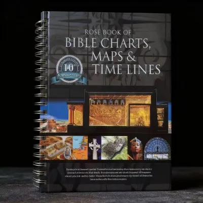
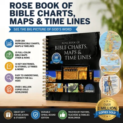
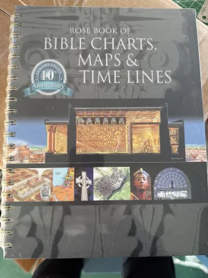
Prices are valid at publication and may change. Please refer to the product page for the latest price.
Additionally, Catholic tradition places immense theological value on the continuity of the early Church and apostolic succession. Maps tracking the missionary journeys of Saint Paul, the travels of Saint Peter, and the establishment of the earliest patriarchal sees provide a vital visual foundation for understanding the Acts of the Apostles and the Epistles. These visual aids show how the Church expanded from a small community in Jerusalem into a global presence across the Mediterranean basin, highlighting the historical roots of Catholic ecclesiology.
Finally, the doctrinal integrity of accompanying commentaries and historical notes is a primary consideration for Catholic readers. Many general bible atlases contain theological commentary that may reflect sectarian biases or historical-critical assumptions contrary to Catholic teachings on biblical inspiration and tradition. Choosing resources that carry ecclesiastical approval, or those written by recognized Catholic scholars, ensures that the geographical explanations harmonize with Catholic hermeneutics and spiritual life.
How to Evaluate Bible Atlases for Catholic Study
To select a high-quality atlas that genuinely enhances your study of scripture, you must evaluate several critical dimensions.

Theological and Historical Alignment Begin by examining the editorial perspective of the atlas. A valuable resource for Catholic study should present historical and archaeological data objectively, without undermining the supernatural dimensions of scripture or the historical reliability of biblical events. Look for authors or editorial boards with established credentials in Catholic biblical scholarship or ecumenical projects that respect Catholic canonical boundaries.
Map Clarity and Topography A map is only as useful as its legibility. Evaluate the quality of the cartography by looking for clear contour lines, distinct color-coding for physical terrain, and legible labels. The topography of the Holy Land—such as the deep depression of the Jordan Rift Valley and the rugged hill country of Judea—directly influenced military campaigns, trade routes, and Jesus’ travels. For instance, understanding the steep elevation change between Jericho (nearly 250 meters below sea level) and Jerusalem (around 750 meters above sea level) adds profound physical context to the parable of the Good Samaritan and Jesus’ final journey to the cross.
Index and Gazetteer Quality An active study routine demands a comprehensive, alphabetized index. The index should list ancient place-names alongside their modern equivalents and provide precise grid coordinates for quick location. A high-quality gazetteer will also include brief historical descriptions of major sites, helping you quickly cross-reference locations as you read through complex narrative passages. This is particularly helpful when tracking obscure towns mentioned in the tribal allotments of the Book of Joshua or the prophetic books.
Contextual Commentary Most atlases feature extensive explanatory text alongside their maps. Evaluate this commentary to ensure it provides rich historical, cultural, and archaeological context. The text should explain the significance of trade routes, agricultural cycles, and regional geopolitics, helping you understand why specific events occurred where they did, while remaining respectful of the sacred nature of the text.
Recommended Types of Bible Maps and Atlases for Catholics
When searching for the right visual aids, you will find that resources generally fall into three main categories, each offering distinct advantages for different study goals.
Dedicated Catholic Bible Atlases
Dedicated Catholic bible atlases are designed specifically to support the 73-book canon and Catholic theological frameworks. These volumes are often published by recognized Catholic academic presses or spiritual publishers. They ensure that the Deuterocanonical books receive dedicated cartographic coverage, allowing you to trace the complex military movements of the Maccatees or the journeys described in the book of Tobit.
These specialized atlases frequently highlight early Church history, mapping the spread of Christianity during the first three centuries, the locations of early ecumenical councils, and the development of monastic centers. Furthermore, they are more likely to feature the Imprimatur and Nihil Obstat, giving you peace of mind that the accompanying historical and theological commentary aligns with Catholic doctrine.
Catholic Study Bibles with Integrated Maps
For many readers, a comprehensive study Bible featuring integrated maps is the most practical, all-in-one solution. Renowned editions—such as those based on the New American Bible Revised Edition (NABRE), the Revised Standard Version Catholic Edition (RSV-CE or RSV-2CE), or the Jerusalem Bible—often include full-color map sections at the back of the book, as well as smaller, black-and-white inline maps throughout the text.
This format is highly convenient for daily reading, parish study groups, and the practice of lectio divina. Having maps directly alongside the biblical text, cross-references, and theological footnotes allows you to quickly verify geographical locations without managing multiple heavy volumes. However, keep in mind that integrated maps are naturally smaller and may lack the detailed topographical shading and extensive historical commentary found in a standalone atlas.
General Historical and Archaeological Atlases
You should not overlook high-quality secular or ecumenical historical atlases, as they offer exceptional academic value. Atlases focusing on the Ancient Near East, Greco-Roman history, and biblical archaeology provide rigorous, unbiased geographical data that can enrich any scripture study. These resources excel at illustrating physical geography, trade routes, and archaeological excavations.
While these general atlases do not focus on Catholic theology and may omit specific coverage of the Deuterocanonical books, their scientific and historical accuracy is universally applicable. When paired with a reliable Catholic study Bible or commentary, a detailed academic atlas serves as an excellent tool for understanding the physical reality of the ancient world.
What to Verify Before Buying a Bible Atlas
Before purchasing a bible atlas, take time to verify several practical aspects to ensure the book fits your study habits, budget, and local environment.
Translation Compatibility Ensure that the place-name spellings and terminology used in the atlas align with your primary Bible translation. For instance, some older or non-Catholic atlases may use different spelling conventions for biblical figures and locations compared to the NABRE, RSV-CE, or the newer English Standard Version Catholic Edition (ESV-CE). Checking this compatibility beforehand prevents confusing discrepancies during intensive cross-referencing.
Physical vs. Digital Formats Consider how and where you plan to use the resource. Large-format physical atlases are ideal for desk study and parish group discussions, as they allow multiple people to view detailed maps simultaneously. However, in the tropical climate of the Philippines, high humidity can cause physical pages to warp, yellow, or develop mold over time. Glossy paper, often used in high-quality color atlases, can stick together if exposed to moisture. If you opt for a physical book, store it in a well-ventilated, dry area, and consider using silica gel packets on your bookshelves to preserve the paper and binding.
Conversely, digital editions and e-books offer portability and searchability, making them highly convenient for commuting or quick reference on a tablet. The trade-off is that smaller screens can make it difficult to appreciate detailed topographical maps, and zooming in may result in pixelation or a loss of overall context.
Edition and Publication Date Always check the publication date and edition of the atlas. Biblical archaeology is an active field, with new discoveries regularly refining our understanding of ancient sites, trade routes, and boundaries. Opting for a recently updated edition ensures you are studying maps that reflect the current archaeological and historical consensus.
Local Sourcing and Sourcing Options In the Philippines, specialized academic and Catholic books can sometimes be challenging to find in general retail stores. Your best option is to visit dedicated Catholic bookstores, such as those run by the Daughters of St. Paul (Paulines Media Centers), St. Pauls, Word & Life Publications, or local diocesan bookshops. These retailers frequently stock Catholic study Bibles and compatible atlases.
If you prefer to browse online, verified local religious distributors and major ecommerce platforms offer a range of options. Prices for basic paperback atlases or study Bibles with integrated maps typically start around ₱500 to ₱1,200, while premium, imported hardcover academic atlases can range from ₱2,500 to over ₱5,000. Be sure to verify the seller’s credentials and check the book’s specific edition details before finalizing your purchase.
Frequently Asked Questions (FAQ)
Do I need a Catholic-specific atlas if I already have a standard Bible atlas?
While a standard Bible atlas covers the geography of the 66-book Protestant canon and the Holy Land exceptionally well, it may lack maps for the Deuterocanonical books and early Church history. If your study regularly includes books like Maccabees or Tobit, or if you want maps that trace early Catholic tradition and apostolic routes, investing in a Catholic-specific or comprehensive academic atlas is highly beneficial.
Are digital Bible map apps sufficient for Catholic study groups?
Digital map apps are excellent for personal study due to their interactive zoom features and portability. However, for parish study groups or community prayer circles, physical atlases or printed map handouts are often superior. Physical books foster a more focused environment by eliminating screen distractions and notifications, and they allow group members to easily share and examine maps together.
How can I verify if a Bible atlas has Catholic approval?
To verify Catholic ecclesiastical approval, check the copyright or title page of the book for the Imprimatur (permission to publish) and Nihil Obstat (declaration that the work is free of doctrinal or moral error). These designations indicate that the book’s written commentary, historical claims, and theological notes have been reviewed by Church authorities, though they do not serve as a scientific guarantee of the cartographic or archaeological accuracy of the maps themselves.
Community discussion
Share your experience or ask a question. Comments are reviewed before publication.